Crater on Asteroid Vesta
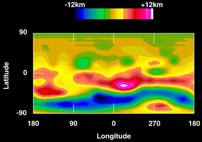
A colour-encoded elevation map of Vesta clearly shows the giant 450 kilometre diameter impact basin and 'bull's-eye' central peak. The map was constructed from 78 Hubble pictures. Surface topography was estimated by noting irregularities along the limb and at the terminator (day/night boundary) where shadows are enhanced by the low Sun angle.
This topographic map of Vesta's surface, based on Hubble Space Telescope observations, is colour coded to reveal altitude variations above a mean surface level.
The southern pole is dominated by a depression (blue) which is a large impact feature.
Credit:About the Image
About the Object
| Name: | Vesta |
| Type: | Solar System : Interplanetary Body : Asteroid |
| Category: | Solar System |