Map of Pluto's Surface
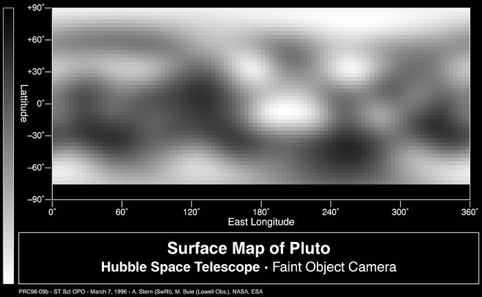
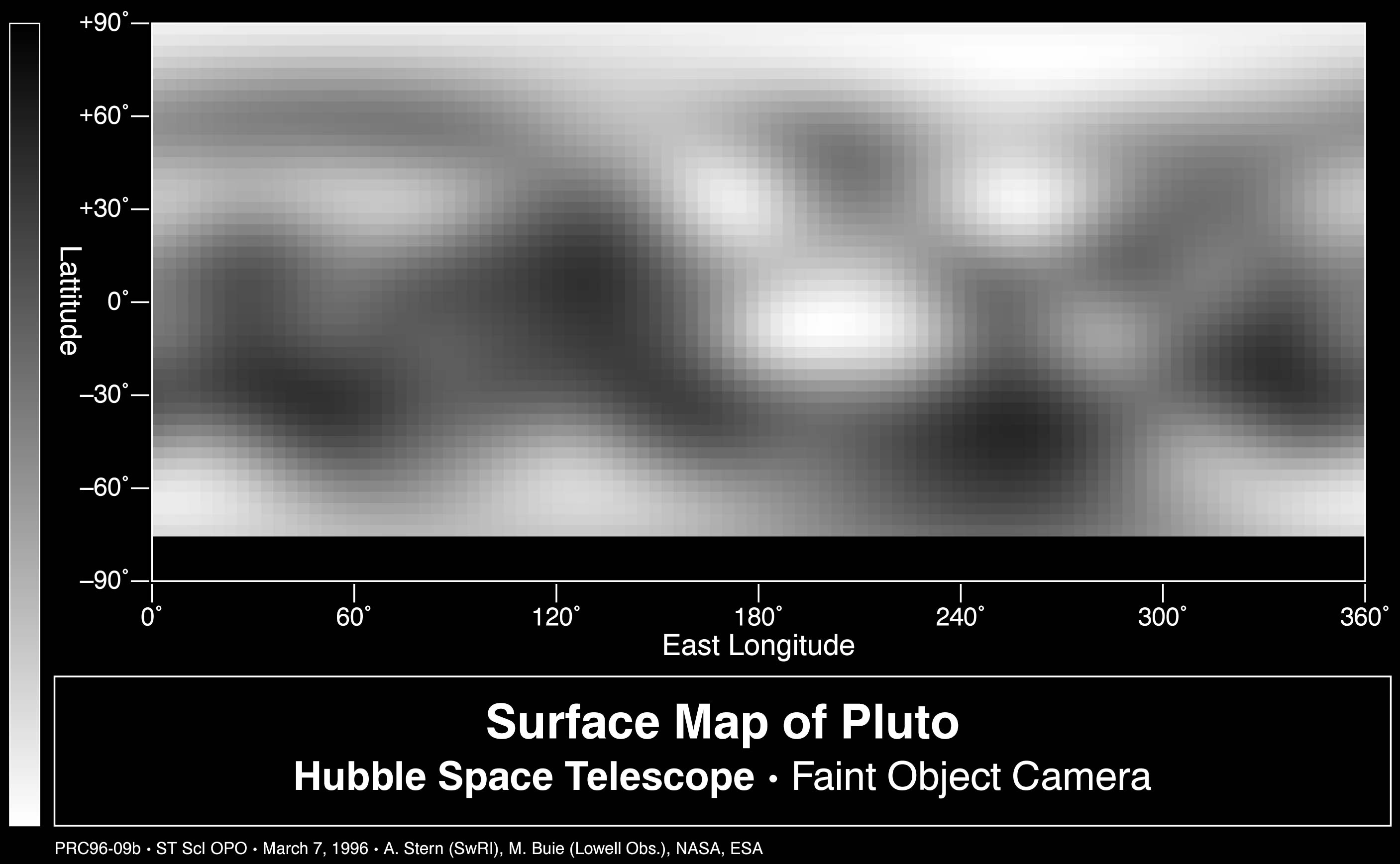
This is the first image-based surface map of the solar system's most remote planet, Pluto.
This map was assembled by computer image processing software from four separate images of Pluto's disk taken with the European Space Agency's (ESA) Faint Object Camera (FOC) aboard NASA's and ESA's Hubble Space Telescope.
Credit:About the Image
About the Object
| Name: | Pluto |
| Type: | Solar System : Interplanetary Body : Dwarf planet |
| Category: | Solar System |
Colours & filters
| Band | Telescope |
|---|---|
| Optical B |
Hubble Space Telescope
FOC |